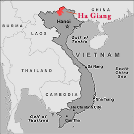
Hà Giang is a province in northeastern Vietnam. It is located in the far north of the country, and contains Vietnam’s northernmost point. It shares a 270 km long border with Yunnan province of southern China, hence it is known as the final frontier of Vietnam. Hà Giang has many high rocky mountains (lime stone formations) and springs; two of its largest mountains are the Cam and Mo Neo. The major rivers of the region are the Lo River (Ha Giang town is located on its left bank) and Mien River. The French occupied this region in 1886, establishing their military garrison on the east bank of the Lo River and which became later in 1905 one of the four major military establishments in French Indo China in North Vietnam. Ha Giang Province also has large areas of green tea, as well as many terraced rice fields. Notable tea plantations of quality tea are the Shan Tuyet strain in the Lung Phin in Dong Van District and Nam La in Yen Minh District.